
For general earthquake action steps (what to do in the first 10 seconds, intensity scale, indoor vs outdoor), see the Japan Earthquake Safety Guide. This post covers Tokyo-specific risks and what to do at the city's most popular tourist spots.
Tokyo's earthquake risk is not uniform
Most visitors think of Tokyo as a single city, but from a seismic perspective it divides into three very different zones.
Yamanote (山の手) — the upland west
Shinjuku, Shibuya, Harajuku, Roppongi. Built on firm ground at higher elevation, these areas experience relatively less shaking and have a low liquefaction risk. Most buildings here are modern, with strong seismic engineering.
Shitamachi (下町) — the low-lying east
Asakusa, Ueno, Kinshicho, Sumida. Formed on soft delta ground since the Edo period, with a concentration of older wooden buildings. Tokyo's own damage simulations for a direct-hit earthquake identify these areas as having the highest fire and building-collapse risk.
Reclaimed land (埋立地) — liquefaction risk
Odaiba, Toyosu, Ariake, Shiodome. During a major earthquake, the ground in these reclaimed Tokyo Bay areas can liquefy — behaving like liquid, causing buildings to tilt and road surfaces to crack. These are some of Tokyo's busiest tourist and shopping districts.
What to do at Tokyo's top tourist spots
🗼 Asakusa · Senso-ji (浅草·浅草寺)
Shitamachi soft ground. Dense wooden buildings nearby mean fire is the main secondary risk.
- In Nakamise shopping street: goods fall from both sides — move to the centre aisle and crouch low
- In Senso-ji grounds: avoid stone lanterns and pillars that can topple; move to the open courtyard
- If you smell smoke after the quake, head immediately toward Sumida Park or Asakusa Park
🏙️ Shibuya · Harajuku · Shinjuku (渋谷·原宿·新宿)
Yamanote upland — ground is relatively safe, but crowd density and complex underground layouts are the risk here.
- Scramble Crossing, Takeshita Street, and other packed areas: move to the edge to avoid crowd crush
- Shinjuku and Shibuya stations are among the world's most complex — follow PA announcements calmly
- In underground malls (Shibuya Hikarie basement, etc.): follow green emergency-exit signs, never run
🏝️ Odaiba · Toyosu (お台場·豊洲)
Reclaimed land. Dual risk: liquefaction and tsunami.
- After the quake, road surfaces may sink and manhole covers may rise — stop any vehicle immediately
- Being on Tokyo Bay means a tsunami warning is possible after a strong earthquake — move to upper floors of a concrete building immediately
- Rainbow Bridge may be closed for inspection — Yurikamome and Rinkai Line resumption could take hours
🗾 Tokyo Skytree · Kinshicho (東京スカイツリー·錦糸町)
Shitamachi soft ground. The Skytree itself has cutting-edge seismic damping and is structurally safe, but the surrounding area is vulnerable.
- In the Skytree observation deck: follow staff instructions; wait for staff guidance if elevators stop
- In the Kinshicho commercial area: older buildings are common — watch for falling facades and signs
🌸 Ueno (上野)
Shitamachi soft ground. National Museum, zoo, and other large venues draw big crowds.
- Inside museums: step away from display cases immediately — glass and exhibit items will fall
- Ueno Park is wide open and suitable as an evacuation space — move to the centre of the park
Tokyo's unique problem — 5.15 million stranded
When the 2011 Tohoku earthquake struck, 5.15 million people in Tokyo found themselves unable to get home. All trains stopped and roads gridlocked as millions attempted to walk home simultaneously.
Tokyo Metropolitan Government subsequently set an official policy: "Do not try to go home on the day of a major earthquake."
As a traveller, this means:
If transport shuts down after a quake:
- Stay inside your hotel, accommodation, or current building
- Wait at train stations, department stores, or convenience stores for service-resumption announcements
- Use Tokyo's designated Kika-Konnansha (stranded person) Support Centres — set up inside stations, schools, and public facilities
- Attempting to walk long distances risks injury and exhaustion
If your travel insurance includes an accommodation extension benefit, an extra night forced by transport shutdown may be partially covered.
Haneda vs Narita — how each airport is affected
| Haneda (HND) | Narita (NRT) | |
|---|---|---|
| Location | Reclaimed Tokyo Bay land | Inland, Chiba Prefecture |
| Liquefaction risk | **Yes** | Low |
| Distance to central Tokyo | 15–30 min | 60–90 min |
| Post-quake reopening | Relatively faster | May be slower if access trains fail |
- Haneda sits on reclaimed land, so runway inspections after a large quake take time
- Narita is far from the city — if trains stop, reaching it is very difficult
- If your return flight is from Narita, identify alternative access (airport bus, taxi) before your trip in case trains are suspended
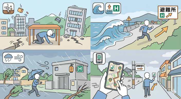
Official resources for Tokyo
- Tokyo Bousai App (
東京都防災アプリ) — English available; nearest shelter and live disaster info - Tokyo ground hazard map — Tokyo Metropolitan Government geology viewer
- JR East live train status — jreast.co.jp/e/traininfo/
- JNTO Tourist Helpline — 050-3816-2787 (24/7, multilingual)
- Your embassy / consulate in Tokyo — save the emergency number before your trip
Related guides