
For general earthquake action steps — what to do in the first 10 seconds, intensity scale, hotel and subway procedures — see the Japan Earthquake Safety Guide. This post covers Kyoto-specific risks and exactly what to do at the city's most visited tourist spots.
Why Kyoto is fundamentally different from Tokyo and Osaka
Kyoto is an inland city. There is no tsunami risk here. But that does not mean it is safe during an earthquake — it means the danger plays out differently.
In Tokyo, the primary concern is liquefaction, stranded commuters, and collapsed wooden housing in older districts. In Osaka, it is the Nankai Trough tsunami reaching low-lying canal areas.
In Kyoto, the danger comes after the shaking stops. Fire spreading through timber alleyways where fire trucks cannot enter. And a fault running beneath the city that most tourists have never heard of.
Kyoto's three unique risks
Risk 1 — The Hanazore Fault (花折断層)
The single biggest earthquake threat in Kyoto is not well known outside Japan. The Hanazore Fault runs north to south through the northern part of the city — passing within a few kilometres of central Kyoto.
Japan's Headquarters for Earthquake Research Promotion (HERP) estimates this fault is capable of producing a direct M7.5 earthquake directly beneath the city. The 1830 Kyoto Earthquake (M6.5) is believed to have originated on this fault.
Unlike the Nankai Trough — which affects much of western Japan — the Hanazore Fault would produce a shallow, direct-strike earthquake. This means intense, concentrated shaking in the city centre with almost no warning.
Risk 2 — Timber heritage buildings and fire
Kyoto has more than 200 nationally designated timber heritage structures — temples, shrines, and historic buildings that have stood for centuries. The surrounding neighborhoods are dense with machiya (町家), traditional wooden townhouses built wall-to-wall along narrow streets.
The lesson from the 1995 Kobe earthquake is instructive: in districts with dense timber housing, fires ignited by the initial shaking spread faster than firefighters could respond. In Kyoto, fire is the primary secondary threat. In areas like Gion and Nishiki, streets are 2–3 metres wide — fire trucks cannot enter.
Kyoto's World Heritage buildings use traditional timber joinery techniques — interlocking wooden joints rather than welded steel — which provide some earthquake flexibility but create unpredictable behaviour under sustained shaking.
Risk 3 — Basin geography limits escape routes
Kyoto sits in a basin surrounded by mountains on three sides — east, west, and north. In a major earthquake, multiple transport corridors can fail simultaneously. The Tokaido Shinkansen, JR lines, Hankyu, and Kintetsu all converge here.
Getting stranded in Kyoto is a real possibility. Unlike coastal cities, there is no single obvious direction to walk to safety. Plan your route from your accommodation in advance.
Kyoto seismic risk zones at a glance
| Area | Primary risk | Note |
|---|---|---|
| Gion · Higashiyama | Dense timber buildings, fire | Fire trucks cannot enter narrow alleyways |
| Arashiyama | Low-lying river floodplain, landslide | Move away from the mountain, not toward it |
| Fushimi Inari | Torii gate collapse on mountain trail | Descend immediately after shaking |
| Nijo Castle · Imperial Palace | Open grounds — relatively safe | Usable as evacuation assembly area |
| Kyoto Station area | Modern structure, but massive crowd stranding | Follow station announcements |
| Kitayama · Sanjo north | Closest to Hanazore Fault | Strongest shaking in a direct strike |
What to do at Kyoto's top tourist spots
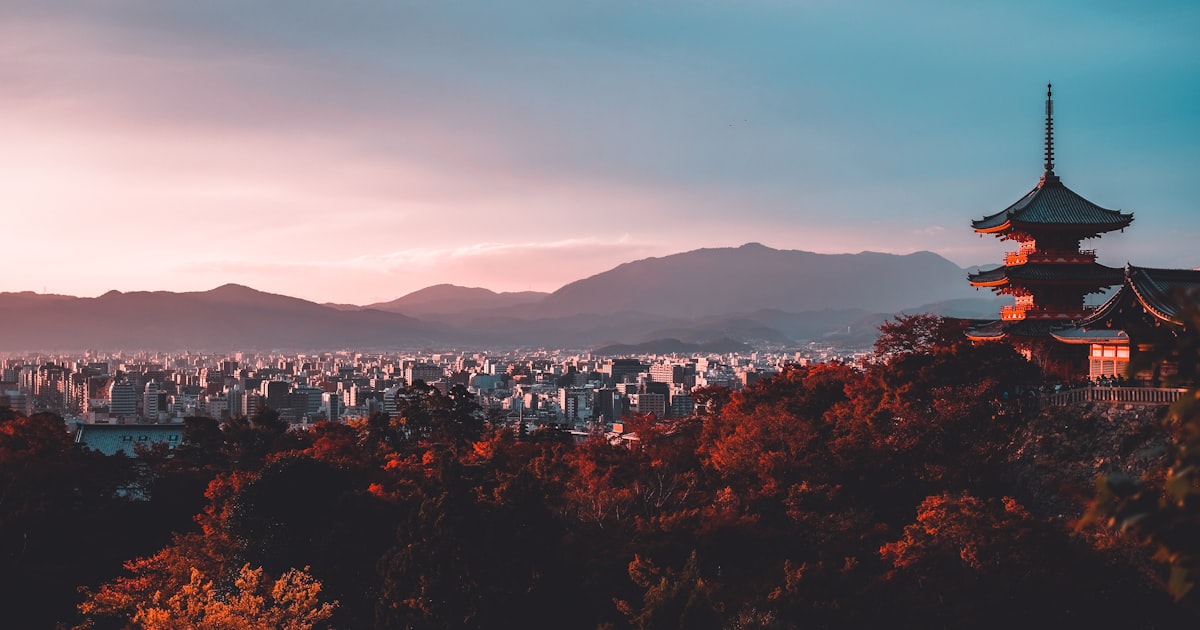
⛩️ Kiyomizudera (清水寺)
One of Japan's most iconic temples, built on a hillside in Higashiyama. The famous wooden stage (butai) stands 13 metres above the ground on a framework of tall pillars — constructed entirely without nails.
The risks:
- The wooden stage and main hall use traditional interlocking timber joints. Strong sustained shaking produces unpredictable movement.
- Sannenzaka and Ninenzaka — the stone-paved lanes leading down — are the only exit routes. They become extremely crowded and dangerous in a panic.
- The surrounding hillside can shed loose rock and debris.
What to do:
- If you are on the wooden stage, grip the railing, crouch low, and move toward the main hall — away from the edge.
- Once shaking stabilises, descend the hill immediately. Do not wait inside the temple complex.
- On Sannenzaka and Ninenzaka, watch for falling roof tiles and move slowly — do not run on wet stone steps.
- If you smell smoke, take the Higashiyama Driveway route rather than the main tourist lanes.
🏮 Gion & Yasaka Shrine (祇園·八坂神社)
The area with the highest fire risk in Kyoto following a major earthquake. Hanamachi (geisha district) alleyways are 2–3 metres wide. Machiya townhouses share walls with their neighbours. A fire starting in one building reaches the next in minutes.
The risks:
- Fire truck access is impossible in most of Gion's backstreets.
- The Gion-Shijo main street has glass-fronted buildings and heavy signage that falls during strong shaking.
- Yasaka Shrine's stone torii gate and stone lanterns can topple.
What to do:
- If you are inside a narrow alley, move immediately toward the wide Shijo-dori or Higashioji-dori. Do not stay between machiya buildings.
- Do not stand under eaves or against outer walls — roof tiles fall.
- At Yasaka Shrine, move to the open centre of the grounds and stay clear of the torii.
- At the first sign of smoke, head toward the Kamo River (鴨川) embankment. The open riverbank acts as a firebreak. This is the most important escape direction from Gion.
🎋 Arashiyama & Togetsu-kyo Bridge (嵐山·渡月橋)
Kyoto's western landmark sits immediately alongside the Oi River (大堰川).
The risks:
- The bamboo grove creates a disorienting environment during shaking. The sound and movement of thousands of bamboo poles amplifies panic — the bamboo itself is unlikely to collapse, but it blocks exits and line of sight.
- Do not stop on Togetsu-kyo Bridge during or immediately after an earthquake. Bridges are inspected and closed after seismic events.
- The steep hillside above the souvenir shops and restaurants can shed landslide debris.
What to do:
- In the bamboo grove, exit onto the path as quickly as possible and move away from the mountain slopes.
- On Togetsu-kyo Bridge, grip the railing and walk to the nearest bank — do not remain on the bridge.
- The wide gravel riverbank alongside the Oi River is the safest open area. Move there and wait.
- Restaurants and accommodation on the hillside side of the road carry landslide risk. Move toward the river, not the mountain.
⛩️ Fushimi Inari Taisha (伏見稲荷)
Ten thousand stone and wooden torii gates line a trail that climbs a mountain. The gates are the hazard.
The risks:
- Each torii is supported by two upright pillars — stone or timber — set into the ground. Strong shaking can topple the pillars sideways across the path.
- The higher you climb, the fewer exit routes exist.
- Evening visits mean low light when the gates fall.
What to do:
- If you are beneath a torii when shaking begins, step sideways into the forest off the path immediately. The pillars fall in the direction the gate faces — stepping sideways gets you clear.
- Once shaking stops, descend toward the main hall (honden) without delay. Do not continue climbing.
- After you reach the base, wait in the open area near Fushimi Inari Station.
🏯 Nijo Castle & Kyoto Imperial Palace (二条城·京都御所)
Two of central Kyoto's best-known historic sites — and both have something the rest of the old city lacks: open ground.
- Nijo Castle: Move away from the stone walls and gates — they can collapse outward. The interior garden is a viable open assembly point.
- Kyoto Gyoen (Imperial Palace Park): This vast open park is formally designated as a wide-area evacuation site for surrounding neighbourhoods. If you are anywhere in central Kyoto and uncertain where to go, head here.
- Both sites have historic timber structures. Exit any building immediately; the open grounds are safer than the interiors.
🚉 Kyoto Station (京都駅)
The station building opened in 1997 and meets modern seismic standards. The structure itself is not the primary concern.
What to do:
- All trains stop automatically during an earthquake. Follow station announcements — they will be broadcast in Japanese, English, Chinese, and Korean.
- Shinkansen, JR, Kintetsu, and the subway all converge here. Expect large crowds and significant delays.
- If you are in the commercial floors (Isetan, Bic Camera), follow emergency exit signs and move outside.
- After exiting, move to the broad Karasuma-dori (烏丸通) and wait for official guidance rather than trying to navigate immediately.
Kyoto's post-earthquake fire risk — what to do in the old city
Kyoto's historical core contains a labyrinth of alleys too narrow for emergency vehicles. If fire breaks out after a large earthquake, it can spread across several blocks before firefighters can reach the area.
Fire principles for Kyoto's old districts:
- Move in the direction opposite to smoke — the clean-air direction is your exit.
- Target the Kamo River or Oi River embankments. Open water acts as a natural firebreak.
- Do not run in narrow alleyways — a fall in a crowded lane is extremely dangerous.
- If smoke is dense, crouch low (smoke rises) and keep your nose and mouth covered.
If your accommodation is in Gion, Nishiki, or Higashiyama, locate the nearest emergency exit and the direction of the Kamo River on the day you check in. It takes 30 seconds and matters enormously if you need it.
Before you go: quick checklist
- If staying in Gion or Higashiyama, identify the exit toward Kamo River from your accommodation
- Save the location of Kyoto Gyoen (Imperial Palace Park) — the nearest official wide-area evacuation site for central Kyoto
- Note that Kitayama and northern Kyoto sit closest to the Hanazore Fault — shaking will be strongest there in a direct-strike event
- Save your country's embassy or consulate number (for Korean travellers: Korean Consulate-General Osaka +81-6-4256-2345, which covers Kyoto)
- Download JNTO's Safety Tips app (multilingual earthquake alerts)
Official resources
- JMA Earthquake Information (English) — jma.go.jp/bosai/earthquake
- Kyoto City Disaster Prevention Portal — city.kyoto.lg.jp (evacuation shelter map)
- JR West Train Status (English) — westjr.co.jp/global/en
- JNTO Tourist Helpline — 050-3816-2787 (24/7, multilingual)
Related guides