
For general earthquake action steps — first 10 seconds, intensity scale, what to do indoors — see the Japan Earthquake Safety Guide. This post covers Fukuoka-specific risks and what to do at the city's most popular tourist spots.
The myth of the earthquake-free city — and what 2005 changed
For most of its modern history, Fukuoka was considered one of Japan's safest cities from earthquakes. It sits far from the Pacific plate boundary, and historical records showed no major seismic events. Many buildings were constructed without the same earthquake-preparedness mindset found in Tokyo or Osaka.
That changed on Sunday morning, 20 March 2005.
The 2005 Fukuoka Earthquake (M7.0)
An M7.0 earthquake struck offshore west-northwest of Fukuoka, registering JMA seismic intensity 6 Lower (震度6弱) in the city's western districts. Building facades crumbled, windows shattered throughout the centre, and the city recorded 1 death and over 1,200 injuries.
The damage was amplified by decades of underpreparedness — a city that had not expected a real earthquake. Since then, Fukuoka has significantly strengthened building inspections and public disaster awareness.
Fukuoka's primary threat — the Kego (警固) Fault
Fukuoka's main seismic risk is not a distant ocean trench like Osaka's Nankai Trough. It is a fault that runs directly under the city.
The Kego Fault Zone is an active fault that cuts through central Fukuoka from northwest to southeast — passing close to Tenjin and Hakata, the city's two main commercial districts. Japan's Headquarters for Earthquake Research Promotion (HERP) assesses the fault as capable of producing an M7.2 direct-hit earthquake (probability under 1% in 30 years).
The probability is low, but the consequence is significant: a direct-hit quake under a city centre is far more damaging per magnitude unit than a distant offshore earthquake.
Fukuoka vs Osaka: Fukuoka is outside the Nankai Trough's direct impact zone. The major tsunami risk that Osaka faces does not apply here. The primary danger is a direct-fault earthquake, not a tsunami.
What to do at Fukuoka's top tourist spots
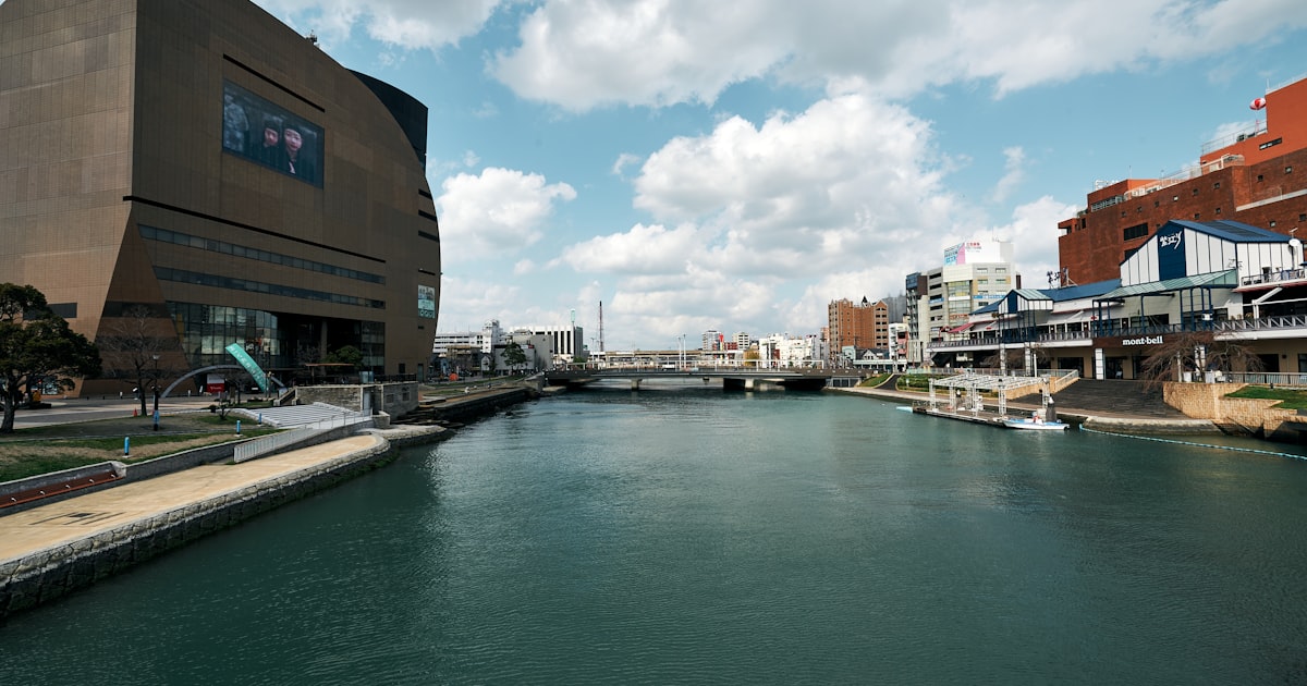
🚉 Hakata Station · Canal City Hakata (博多駅·キャナルシティ博多)
The gateway to Fukuoka — where Shinkansen, JR, subway, and buses all converge.
- Hakata Station is a large complex: all trains stop automatically during earthquakes; follow PA announcements and move calmly to the exterior
- Canal City has an artificial canal running through the interior structure — watch for falling objects near the waterway; move to the open central plaza
- The older Hakata district surrounding the station has ageing buildings with facade and signage that can fall
🏙️ Tenjin · Tenjin Underground Shopping Centre (天神·天神地下街)
Fukuoka's main shopping district — and the area closest to the Kego Fault.
- Tenjin Underground Shopping Centre runs beneath the district: during any earthquake, exit to street level immediately — risk of fire, falling fixtures, and flooding
- Once above ground, the open area in front of Solaria Plaza or Iwataya department store is a suitable temporary gathering point
- Inside department stores (Iwataya, Parco): step away from shelves, do not use elevators, use stairs
🌉 Nakasu (中洲) — the island district
Nakasu is a river island between the Naka River (那珂川) and Hakata River (博多川) — one of Japan's most famous entertainment districts, packed with yatai (street food stalls) and restaurants.
Why it is a unique risk:
If earthquake damage or safety inspections close the bridges around Nakasu, the district becomes temporarily cut off from the mainland. Multiple bridges connect it, so total isolation is an extreme scenario — but bridge closures for inspection after strong shaking are realistic.
- If you are on Nakasu: cross to the mainland as soon as shaking eases, as long as the bridge shows no obvious damage
- At a yatai (outdoor food stall): cooking equipment and tables will fall during shaking — move into a building or open space immediately
- Low-lying area: be alert to river flooding if heavy rain accompanies the earthquake
🏖️ Momochi Beach · Fukuoka Tower (百道浜·福岡タワー)
The Seaside Momochi district — including Fukuoka Tower and PayPay Dome — is built on reclaimed land.
- Like Tokyo's Odaiba, this area carries liquefaction risk in a major earthquake
- Fukuoka Tower itself is seismically engineered, but surrounding roads and car parks can sink or crack
- PayPay Dome (baseball stadium) sits on the same reclaimed land: if shaking occurs during an event, follow staff directions and avoid rushing toward exits simultaneously
- Momochi faces the Genkai Sea but tsunami risk here is lower than the Osaka Bay coast
🌲 Ohori Park (大濠公園)
A large city-centre park adjacent to the Fukuoka Castle ruins (Maizuru Park).
- Wide open space — suitable as an evacuation gathering point
- Stay away from the edges of the large central pond during shaking; the grassy open area is the safest part
- The old stone walls of Fukuoka Castle ruins: aged masonry — do not stand close to them during aftershocks
⛩️ Dazaifu Tenmangu (太宰府天満宮)
A major historic shrine about 40 minutes from Hakata by Nishitetsu Railway.
- Many wooden shrine buildings: roof tiles can fall during shaking — if inside the main hall (拝殿), move toward the exit rather than gripping columns
- The wide approach path (参道) and open shrine grounds can serve as an evacuation space
- If the Nishitetsu line stops after a quake, wait for resumption — walking back to Hakata is not practical
Fukuoka's subway — the airport advantage
Fukuoka's city subway has three lines:
| Line | Key route | Traveller use |
|---|---|---|
| Airport Line (空港線) | Fukuoka Airport ↔ Tenjin ↔ Hakata | ★★★ |
| Hakozaki Line (箱崎線) | Nakasu-Kawabata ↔ Kaizuka | ★ |
| Nanakuma Line (七隈線) | Hashimoto ↔ Hakata | ★★ |
The airport advantage: Fukuoka Airport is approximately 5 minutes from Hakata Station by subway — one of the shortest airport-to-city distances in Japan. After a major earthquake, once the subway resumes, reaching the airport is significantly faster here than in Tokyo or Osaka. This is worth factoring into your contingency planning.
During an earthquake: trains stop automatically. If you are in a tunnel, wait for staff instructions — do not walk along the tracks yourself.
Fukuoka and typhoons — Kyushu's high exposure
Separately from earthquake risk, Fukuoka requires extra vigilance during typhoon season (July–September).
Kyushu sees more typhoon impacts than any other region of Japan. When a typhoon makes landfall or passes close to Kyushu, Fukuoka experiences strong winds and heavy rain.
Fukuoka-specific typhoon impacts:
- Fukuoka Airport — direct-hit typhoons cause major disruption and widespread cancellations; check your airline app from the day before departure
- Ferry connections from Hakata Port — services to the Korean peninsula and domestic island routes suspend during typhoons; if your itinerary includes a ferry leg, build in 2–3 buffer days
- Genkai Sea storm surge — when typhoons track through the Korea Strait, high waves can reach the Momochi seafront; avoid coastal areas during warnings
For general typhoon advice → Japan Typhoon Season Guide
30-second pre-trip checklist
- Check your accommodation on Fukuoka City's hazard map (search Fukuoka City hazard map to enter your address)
- Note the Airport Line route: Fukuoka Airport ↔ Hakata ↔ Tenjin (your first option once subway resumes)
- If visiting Nakasu: identify the nearest bridge to the mainland before you need it
- Save emergency contact: JNTO Tourist Helpline — 050-3816-2787 (24/7, multilingual)
- Save your country's embassy or consulate emergency number
Official resources for Fukuoka
- Fukuoka Prefecture Disaster Prevention — pref.fukuoka.lg.jp/contents/bousai.html
- JR Kyushu train status — jrkyushu.co.jp
- Nishitetsu Railway status — nishitetsu.jp (Dazaifu and southern Fukuoka routes)
- JNTO Tourist Helpline — 050-3816-2787 (24/7, multilingual)
Frequently asked questions
Is Fukuoka safe from earthquakes for tourists? Fukuoka is generally safe to visit. The main risk is the Kego Fault, which runs under the city centre, but the 30-year probability of a major earthquake is under 1%. Visitors should know the nearest evacuation point and avoid the Tenjin Underground Shopping Centre during any shaking.
What happened in the 2005 Fukuoka earthquake? On 20 March 2005, an M7.0 earthquake struck offshore west-northwest of Fukuoka, producing JMA seismic intensity 6 Lower (震度6弱) in the city's western districts. One person died and over 1,200 were injured. The quake caused facade damage throughout central Fukuoka and revealed the city's underpreparedness.
Is there a tsunami risk in Fukuoka? Fukuoka's tsunami risk is lower than Pacific-facing cities like Osaka or Tokyo. The city does not face the Nankai Trough directly. Some coastal risk exists from the Genkai Sea during very strong offshore earthquakes, but it is not the primary danger — the Kego Fault is.
What should I do if there is an earthquake while I am in Nakasu? Move to the mainland immediately once the shaking eases — as long as the bridge shows no obvious damage. Nakasu is a river island; bridges may close for inspection after strong shaking, temporarily cutting off the district. Do not wait to assess the situation if you can safely cross.
Will the Fukuoka subway stop in an earthquake? Yes. All subway trains in Japan stop automatically when sensors detect shaking above a threshold. Wait inside the train or station for staff instructions. Once the subway resumes, the Airport Line gives Fukuoka travellers an advantage: Fukuoka Airport is just 5 minutes from Hakata Station.
Related guides